Hunting apps have been around for some time now, and they certainly aren’t going away anytime soon. Whether you’re e-scouting a piece of public ground a thousand miles from home, sharing stand locations with your hunting partners, or mapping out future food plot locations, hunting apps are an integral piece of our hunting routine.
With the serious whitetail hunter in mind, the team at HuntStand has just released a variety of innovative new features. These include new mapping layers and a whitetail activity forecast powered by decades of research from America’s top whitetail biologists.
Whitetail-Specific Map Layers
HuntStand is widely known for the variety of different map layers they make available with their Pro subscriptions. Whether you’re looking for topographical maps, aerial maps, or public land maps, they’ve got you covered.
Now included with the Pro Whitetail subscription are several additional map layers geared specifically towards whitetail hunting.
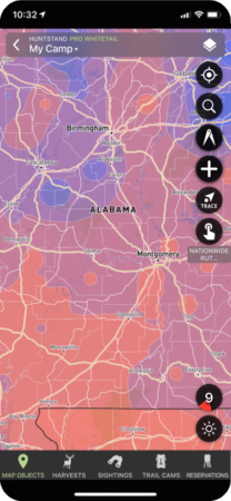
Rut Map
The Whitetail Rut Map is exactly what it sounds like. A heat map of the current rut status throughout the United States. Using data acquired from wildlife biologists in every state, this is the most accurate representation of where the whitetails are at in the pre, peak, and post-rut cycle.
Monthly Satellite Imagery
Satellite images are great for remotely scouting areas before you visit them. But they are often out of date or taken during the green summer months when you’re hunting after leaf drop in the fall.
With satellite images updated monthly you can be sure you’re always looking at recent data the coincides with the time when you’re be hunting.
Whitetail Habitat Map
Using decades of observed data combined with advanced satellite measurements, the team at HuntStand has created a map which highlights terrain and habitat that may be most suitable for whitetails. This is a useful tool for remote scouting when you’re looking for a starting point to hit the ground running (literally).
Whitetail Activity Forecast
Predicting whitetail movement is something hunters have been trying to do since the dawn of mankind. Knowing when and where an animal is likely to be at a specific point in time is often the key to killing them. And while there are other deer prediction apps on the market, most are based on anecdotal evidence and pseudo-science.
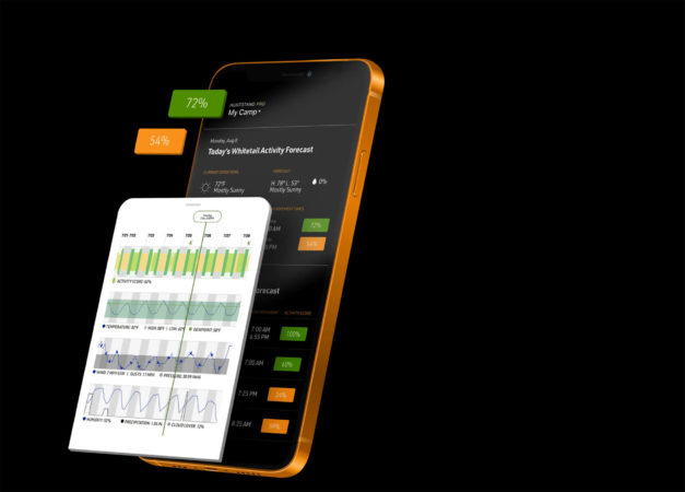
The HuntStand whitetail activity forecast is based on decades of scientific research from America’s top whitetail biologists. They analyzed over a dozen variables at any given point in time to give you a better chance to be in the woods when the deer are moving.
The 7-day forecast shows peak movement times along with helpful weather information including wind direction, wind speed, barometric pressure, cloud cover, and more.
For just $69.99/year, HuntStand’s Pro Whitetail subscription is a steal. You no longer need to subscribe to multiple apps to get all of the information you need at your fingertips. Detailed weather information, mapping tools, and the whitetail activity forecast are all included in one spot.
So the only question is – what are you waiting for? Visit HuntStand.com for more information.

 By
By 