LAST UPDATED: May 1st, 2015
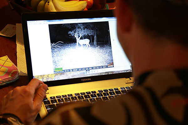
There has been no shortage of advances in hunting equipment, technology, and tactics in recent years. Bowhunters now have faster and more forgiving bows, straighter, stronger arrows, cameras that allow us to monitor animal activity in the field while we sit in the comfort of our homes, and countless other progressions that improve our odds of success by enabling us to hunt smarter, longer, and with more encounters.
“Scouting with digital resources helped me identify a “honey hole” that produced this mature buck.”
An often overlooked, but truly monumental innovation is the ability to use technology to scout properties without ever putting boots on the ground. I have the ability to sit at home in Missouri and scout for new properties near me, in other parts of the Midwest, or even in another part of the country altogether. As I prepared for my first elk hunt in Colorado, I used digital topographic maps, historical satellite imagery, and dozens of other land information details, such as hunting unit or zone boundaries, roads and trail markers, land access points, permanent and seasonal water sources, land cover types, and much more.
Access to this information is incredibly valuable, but bringing all of the various data points, maps, and imagery with you can be a frustrating task. I used to spend hours and hours collecting and then attempting to combine this information, but then I found out about Hunting GPS Maps from onXmaps.
What Makes Hunting GPS Maps by onXmaps So Great?
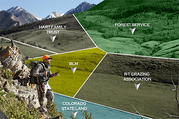
Not only does Hunting GPS Maps instantly give me what I used to spend hours trying to bring together, it provides even more. Their mapping resources include boundaries, such as – counties, hunting and game management zones/units, and color-coded land ownership with property lines. Hunting GPS Maps will not only tell you where public land is located, it will tell you if it is under the management of Forest Service, Bureau of Land Management (BLM), designated Federal Wilderness, the state, or other local government entities.
When it comes to private land, Hunting GPS Maps will show you exact boundaries and land ownership information, including the landowner name (where available). All of this data is updated every year with the most current state and national land survey data. I have personally used this information to successfully inquire about and attain hunting rights to private land near me.
Hunting GPS Maps will change the way you see the lands around you, and will give you the information that you need to be successful.
Scouting At Home
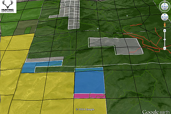
Hunting GPS Maps are offered for a variety of platforms. Their computer-based products integrate with Google Earth or Garmin’s Basecamp software on your Mac or PC. If you want to scout from afar, this is the way to do it! When you integrate Hunting GPS Maps with Google Earth you will have the ability to view current and historical satellite imagery with numerous overlays that can be turned on or off at anytime.
By using the land ownership overlay, which color-codes everything in Google Earth for me, I can quickly scan for new areas of huntable public land. By using the road and trail data I can identify my access routes. Or, by using the landownership information that is provided for private lands, I can contact the owner and request “right of way” permission to access public parcels that are land-locked or are otherwise difficult to reach. Google Earth powered with Hunting GPS Maps has changed the way that I hunt, scout, and find new hunting opportunities.
Hunting GPS Maps transforms Google Earth by color-coding land ownership, and management types, as well as showing roads (in green) and trail (red) that aren’t always visible.
Supercharge Your GPS
Having all of this information available at home is great, but what about taking it into the field? That’s possible, thanks to the ability of Hunting GPS Maps to integrate with compatible Garmin GPS units. Hunting GPS Maps are offered on microSD cards that can be installed directly into many Garmin units, and they also offer the option to download and install the mapping platform from the web, and transfer it to your device.
The properties, boundaries, trails, and water sources that you scout from home can be accessed and easily identified while you’re hunting. The GPS products also feature digital maps with up to 24K-level topography detail, and offer the ability to have the same color-coded land ownership and management information – so you’ll always know exactly where you’re hunting, and can be sure that you are on the property that you have permission to hunt.
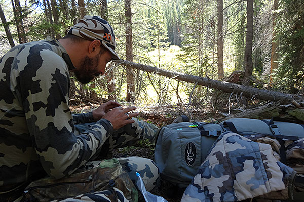
When weather affected elk behavior, the author and his hunting partner used Hunting GPS Maps in the field to identify new public areas to hunt.
No Device, No Problem
What if you don’t have a Garmin GPS? No problem. If you have a smartphone or tablet, then you can use the new “HUNT App” from onXmaps, which brings the power of Hunting GPS Maps to your iOS or Android device.
This app brings many of the features that we have already discussed and puts them right on the device that you use everyday. Take advantage of your device’s ability to know your location and see yourself right on the screen, amidst all of the data that you need. The app allows you to turn certain “layers” of information on or off, and can even download specified layers for offline use. This means that you can extend the battery life of your phone by turning off your data and Internet capabilities, but still have access to mapping resources that have been downloaded and cached for offline use.
Power & Knowledge
There is no point in having all of this information available if you don’t understand how to use, or how to leverage the data to make your hunting more effective. Thankfully, onXmaps doesn’t just provide Hunting GPS Maps products they also teach you how to use them. They provide technical and installation Instructions, as well as Video Tutorials to help you hunt smarter.
Hunting GPS Maps products are available on a state-by-state basis. To learn what products are available in the state(s) that you hunt, and what level of detail that state offers, visit the Map Availability page.

 By
By 